OzRunways EFB 11.1.6
Free Version
Publisher Description
APPROVED BY Australian CASA under CASR 175.
(See support.ozrunways.com/kb FAQ for information).
Download now for a 1 month free trial.
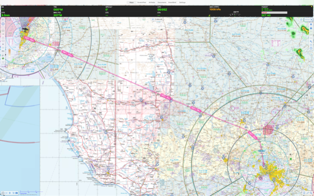
Download aeronautical publications onto your iPhone & iPad. See your position on every aviation map.
Properly licensed documents ensure you will stay up-to-date with the latest amendments of:
- Australian MAPS (Every updated VTC, VNC, WAC, ERC High/Low & PCA), ERSA, DAPS and AIP.
- New Zealand ERC, VNC, Topographic 250k/50k, Vol 1-4 and LINZ Satellite maps.
- Latin America maps and approach charts
- South African 500k/1M/250k aero maps, plus entire continent TPC, ONC and OpenStreetMap.
- Select European maps and charts
- Global custom-made OpenStreetMap with airspace.
- Skyvector global ERC and VNC maps
Features:
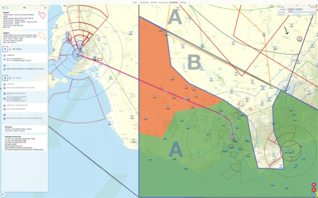
- Weather radar with lightning
- Live flight tracking over cellular network
- Weight & Balance
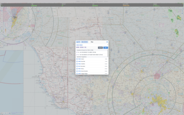
- Flight planner
- See your aircraft position on selected approach plates and taxi diagrams
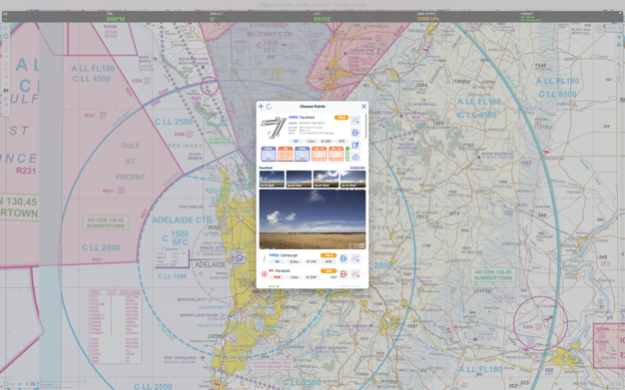
- GPS Moving maps with every waypoint/Navaid in the world from official databases.
- Online and offline street address search.
- Download all maps and charts for offline use.
- Print documents to compatible printers using Apple AirPrint.
- Full text search of AIP.
- Download on demand (then save), or download all documents at home for offline use.
- Annual subscription based login, so you aren't paying full price for a publication 1 week before it expires.
- Night-time mode on iPad to reduce brightness.
Use must be in accordance with applicable aviation regulations.
See https://support.ozrunways.com/kb FAQ for details.
Oct 4, 2023
Version 11.1.6
Live text recognition on Approach Plates (requires iOS 16)
Sort Document folders with EnterpriseDB Folders green at the top
SmartPlates better support arcing and ILS approaches
ADSB Traffic: Show your own aircraft as green
Faster weather radar tiles
Fix visual anomaly when switching approach charts in Dark Mode
Fix Enterprise Dashboard documents with custom to/from validity using the wrong timezone
Fix NAIPS when exporting a multi-stage flight plan, with one leg that has AWK
Fix crash on iOS17 in Aircraft Detailed Performance section
Fix crash in Quick-Plan
Fix Chart Selection list sometimes showing a tick on the wrong item
Fix NZ Preflight sometimes using old credentials after changing login
Fix NAIPS Wind/Temp profile for flights above F450
Remove subscription requirement for eAWIS
Fix issue where duplicating Aircraft would sometimes not refresh UI
Fix "Clear Track History" re-appearing after app restart
Fix bug where new plans would recenter incorrectly on some devices
Better grouping of NZ SID/STAR plates into the appropriate group in Airfields Improvement
Performance improvements
About OzRunways EFB
OzRunways EFB is a free app for iOS published in the Recreation list of apps, part of Home & Hobby.
The company that develops OzRunways EFB is OzRunways Pty. Ltd.. The latest version released by its developer is 11.1.6. This app was rated by 2 users of our site and has an average rating of 3.5.
To install OzRunways EFB on your iOS device, just click the green Continue To App button above to start the installation process. The app is listed on our website since 2023-10-04 and was downloaded 97 times. We have already checked if the download link is safe, however for your own protection we recommend that you scan the downloaded app with your antivirus. Your antivirus may detect the OzRunways EFB as malware if the download link is broken.
How to install OzRunways EFB on your iOS device:
- Click on the Continue To App button on our website. This will redirect you to the App Store.
- Once the OzRunways EFB is shown in the iTunes listing of your iOS device, you can start its download and installation. Tap on the GET button to the right of the app to start downloading it.
- If you are not logged-in the iOS appstore app, you'll be prompted for your your Apple ID and/or password.
- After OzRunways EFB is downloaded, you'll see an INSTALL button to the right. Tap on it to start the actual installation of the iOS app.
- Once installation is finished you can tap on the OPEN button to start it. Its icon will also be added to your device home screen.
Program Details
General |
|
|---|---|
| Publisher | OzRunways Pty. Ltd. |
| Released Date | 2023-10-04 |
| Languages | English |
Category |
|
|---|---|
| Category | Home & Hobby |
| Subcategory | Recreation |
System requirements |
|
|---|---|
| Operating systems | ios |
Download information |
|
|---|---|
| File size | 37.22 MB |
| Total downloads | 97 |
Pricing |
|
|---|---|
| License model | Free |
| Price | N/A |
Version History
version 11.1.6
posted on 2023-10-04
Oct 4, 2023
Version 11.1.6
Live text recognition on Approach Plates (requires iOS 16)
Sort Document folders with EnterpriseDB Folders green at the top
SmartPlates better support arcing and ILS approaches
ADSB Traffic: Show your own aircraft as green
Faster weather radar tiles
Fix visual anomaly when switching approach charts in Dark Mode
Fix Enterprise Dashboard documents with custom to/from validity using the wrong timezone
Fix NAIPS when exporting a multi-stage flight plan, with one leg that has AWK
Fix crash on iOS17 in Aircraft Detailed Performance section
Fix crash in Quick-Plan
Fix Chart Selection list sometimes showing a tick on the wrong item
Fix NZ Preflight sometimes using old credentials after changing login
Fix NAIPS Wind/Temp profile for flights above F450
Remove subscription requirement for eAWIS
Fix issue where duplicating Aircraft would sometimes not refresh UI
Fix "Clear Track History" re-appearing after app restart
Fix bug where new plans would recenter incorrectly on some devices
Better grouping of NZ SID/STAR plates into the appropriate group in Airfields Improvement
Performance improvements
version 11.1.5
posted on 2023-08-16
Aug 16, 2023
Version 11.1.5
Make Enterprise Dashboard folders a different colour in Settings > Documents
Aircraft own-ship icon in DAPS fades/disappears if poor GPS signal
Fix date/time picker hidden
Fix plain text TAF decode for "TL" > "Till"
Fix some W&B text clipped
Fix Cursor Terrain showing "404" label instead of "Ocean"
Fix crash in Settings > Information
Fix BULLSEYE range arcs rendering distance
Update Gove BoM Radar details
version 11.1.3
posted on 2023-07-26
Jul 26, 2023
Version 11.1.3
- New Zealand frequencies (tap on map)
- METAR text highlights any rainfall last 10mins for awareness
- METAR text highlights Temp/Dewpoint that are within 1ºC of each other
- NVFR LSALT splay type can use RNP2 Published value
- Improved performance & battery life
- Bug fixes
version 11.1.2
posted on 2023-07-06
Jul 6, 2023
Version 11.1.2
- Performance and battery improvements
- Fix DAPS drawing controls being obscured by the timer icon (if enabled)
- Fix for ADSB Visible Traffic showing zero in Settings
- Remove Plain Text TAF decode button for SIGMETs in SmartBrief
- Fixed some labels showing am/pm during 24hr time
- Fix sometimes OzRunways UserID wouldn't send in NAIPS RMK field
version 11.1.1
posted on 2023-06-21
Jun 21, 2023
Version 11.1.1
== V11.1.1 ==
• Bug fixes
version 11.1.0
posted on 2023-06-14
Jun 14, 2023
Version 11.1.0
== V11.1 ==
NEW Frequency Navigator shows associated frequencies for aerodromes & helipads when selecting a waypoint from the Closest Points popup (AU Only - NZ Coming Soon)
Enterprise customers can now request custom ScratchPad templates
IFR route suggestions now show total distance for each route
Range ring selector design improvements
ETD selector now correctly shows 24hr format
DAP chart viewer optimisations on iPhone
Fixed an issue where the map would unintentionally open over Antarctica
Fixed an issue where NAIPS could return a blank screen on plan submission
Fixed an issue where deselected Weight & Balance stations were being printed
Fixed an issue where theme selector could display no selection
Added “Enable Lateral Entry” toggle in Weight & Balance Profile for ease of access
Improved password creation logic to prevent unwanted email changes
version 11.0.9
posted on 2023-04-26
Apr 26, 2023
Version 11.0.9
• Fix crash when downloading documents on demand
version 11.0.7
posted on 2023-03-30
Mar 30, 2023
Version 11.0.7
• Fixed: Weight and Balance configuration selector was not working in plan sheet
• Fixed: selecting a different Aircraft in the pop over wouldn’t update the Weight and Balance load sheet
• Fixed: status/loading padding on text fields (e.g. sign up screen)
• Fixed: importing a plan wouldn’t select the associated aircraft profile (if available)
• Fixed: importing plans may not include departure date
version 11.0.6
posted on 2023-03-27
Mar 27, 2023
Version 11.0.6
• Improved stability for fuel tables in the weight & balance profile
• Enhanced accuracy of heading information
• Removed unnecessary commas in the TAF decoder
• Resolved an issue with loading weight and balance settings when printing
• Prevented an extra blank aircraft profile from being created when importing fails
• Enhanced GPX track processing speed
• Streamlined aircraft profile fields
• Improved help text and text formatting for performance categories
• Modified the account deletion warning to require user input before proceeding
• Prioritised GPS tracking over compass when moving above 3 knots
• Adjusted text colour for ETA in dark mode
• Fixed an issue with emergency mode
version 10.4.0
posted on 2021-12-06
Dec 6, 2021 Version 10.4.0
• Revamped Radar/Windy/Satview screen: full support for iPhone, zoom in & out, play/pause controls for the BoM weather radar
• Updated Avidyne SDK for iOS 15
• Terrain Overlay now goes back to ground mode after dismissing the LSALT assistant
• LSALT assistant is now available in New Zealand
• Fixed: incorrect distance displayed on HSI
• Fixed issue where airfields book menu could loose sections on a reload
• Improved reliability of regions list in onboarding. Selection is now limited to those available for the subscription
• Apple Maps overlay now supports track up rotation
• Improved map screen stability
• OzRunways now copies (instead of moving/removing) files from the Files app when importing
• Radial Range waypoints are now treated as custom waypoints when adding or editing a range ring
• If loading user data fails the first time it will now try again on app resume, also added a retry button to the error prompt
• Removed old map layout
• General stability improvements
version 10.3.7
posted on 2021-10-19
Oct 19, 2021 Version 10.3.7
Fixed a stability issue
version 10.3.5
posted on 2021-10-08
Oct 8, 2021 Version 10.3.5
• Fix for duplicate traffic bubbles on map
• Archive all Aircraft now uses a system share sheet
• Fix ScratchPad not printing when it's the only item in PDFPack
• Fix crash in airfields tab that could happen when selecting a favourite
• Fix crash that could occur when printing fuel sheet with invalid values
version 10.3.4
posted on 2021-10-07
Oct 7, 2021 Version 10.3.4
• Improvements to display and refresh of traffic icons
• Improvements to Terrain rendering (iOS 14+)
• Group airfield documents to RNAV/RNP with new title format
• 'Clear Tile Cache' also deletes cached terrain tiles
• Fixed an issue where the bearing line wouldn't update immediately after sequencing
• Fixed a stability issue in W&B configuration when deleting a row while editing another
• Fixed a stability issue that could occur when tapping on multiple pop up buttons at once on Airfields
• Fixed a stability issue when selecting terrain LSALT icons on old map screen layout
• Fixed a stability issue in background downloads
• Fixed Airfields page not switching PDF -> HTML document
version 10.3.3
posted on 2021-09-21
Sep 21, 2021 Version 10.3.3
- Added ScratchPad option to PDF Pack Feature
- Traffic slightly prioritise newer hits over older DR tracks
- Fix to allow LSALT splays to be shown on iOS 12
- Added ability to remove prices from fuel bowser listings
- Improved speed and stability for weather overlay
- Fixed an issue where track history might not show up
- Fixed a crash that could occur when exporting aircraft profiles
- General stability improvements
version 10.3.2
posted on 2021-09-13
Sep 13, 2021 Version 10.3.2
- Fixed an issue that would cause track history crumbs to be drawn incorrectly
- Airfields page: When viewing a document, the drop down Document List now updates on open
- Fixed the colour of the Settings Page navigation bar (iPhone)
- Fixed an issue where the track line could draw incorrectly for some long plans
version 10.3.1
posted on 2021-09-09
Sep 9, 2021 Version 10.3.1
• Downloads System: an alert will be shown if OzRunways hasn't been able to check for database updates for more than 7 days (36hrs on company/organisation accounts)
• Fixed: altitude optimiser now shows correct altitudes again
• Use own ship as ADS-B pressure altitude reference
• Improvements to the accuracy of Smart Airfields search results
• Fixed a satellite zoom issue for a future iOS
• New installs now show AD & ALA overlays by default
version 10.3.0
posted on 2021-08-31
Aug 31, 2021 Version 10.3.0
== New: LSALT Assistant (Australian Premium subscribers) ==
• The LSALT Assistant depicts the tallest obstacle and terrain – inside the selected splay – on the map
• Calculates and presents LSALT options for obstacle and terrain (plus buffers), Grid LSALT, and Route LSALT
• Back and forward buttons to move between legs
• Terrain Overlay gives a visual indication of terrain relative to selected LSALT
• To open the LSALT Assistant: tap a route leg so it turns yellow, and then tap the splay shaped icon in the Right Sidebar
== New: Terrain Overlay (Premium subscribers) ==
• The Terrain Overlay is a visualisation tool. It provides a coloured overlay of terrain on top of the selected map, dynamically updated based on relative GPS altitude
• Turn the Terrain Overlay on/off in Map View Options
== Other fixes, updates, and improvements ==
• New Cursor option to show terrain elevation (Premium subscribers)
• Improved Ruler design and added ability to select units for distance, bearing, and course (long press on ruler for options)
• PDF Pack now selects charts within +/-1 hour of entire flight duration only. Improved formatting of NOTAMs and weather briefings
• Added printer footer to plan sheet and generated PDF pack to include print time
• Better waypoint prioritisation in Closest Points popup
• Rocket Box preference moved to Map View Options
• Plan Sequencer now correctly updates when adding/removing points in plan
• Increased touch radius for tapping on route legs, making them easier to tap
• Improved Quick Plan waypoint selection/suggestion
• Fixed an issue where OzRunways could report incorrect altitude when using an ADS-B receiver containing a barometer
• Fixed an icon size issue in Quick Plan list
• Fixed an issue that occurred when deleting waypoints from the plan sheet in succession
• Fixed an issue where ADS-B traffic may correct for QNH twice
• Fixed an issue that could prevent saving a database backup
• Fixed an issue where having a leg of 0 distance would ignore altitude change
• Fixed an issue where the download indicator in Settings wouldn’t update when changing regions
• Fixed an issue where rows in the plan sheet had troubles changing values when in edit mode
• Fixed an issue where waypoint icons may not be completely centred on the map where there is multiple lines of text
version 10.2.1
posted on 2021-07-27
Jul 27, 2021 Version 10.2.1
* Preparations for NAIPS AIP ENR1.10 update (additional Polar, Desert, Maritime, Jungle fields)
* Fix for sharing plans with invalid characters in name
* Fixed: default refuel amount now applies correctly on plan sheet again
* Fixed: 'New inverted plan' option now correctly inverts plan again
* Fixed: GPS HUD XTK value now displays correct units
* Fixed an issue with ozwpt:// URLs not opening
* Show decimal keypad for fuel price entry on iPhone
* Removed requirement for case sensitive waypoint codes in Quick Planner
version 10.2.0
posted on 2021-07-04
Jul 4, 2021 Version 10.2.0
## New Features ##
** Plan Progress box **
• Replaces the old Plan Progress box that appeared underneath the GPS HUD. Available on new map screen layout only.
• Turn on/off using dedicated button on Right Sidebar (only shown when in a plan)
• Displays last passed waypoint & time, ETA to the active waypoint, and next landing point ETA
• Left & right arrows to sequence plan back and forwards
• Floating box, can be moved anywhere on the screen
** Great Circle everything **
• New styling for planned track line & rocket boxes on the map
• New, easier to read, Grid LSALT styling
• Route legs follow great circle curvature, rocket boxes show initial bearing and great circle distance
• GPS HUD distance & bearing information now shows great circle details
• LSALT splays drawn to follow great circle legs
• Improved TOD point calculations and display
• Previous/passed route legs are greyed out
• Horizontal Terrain view shows the cross section of terrain and air space following the great circle line
• When 'rubber banding', line will follow great circle as dragged
• Ruler: distance & bearings are in great circle (but still drawn as straight line)
## Improvements, changes & fixes ##
• Closest Points (tap on map) -> Wx/Notams now supports fallback to offline SmartBrief cache (Australia only)
• HSI wind speed / direction now updates live based on planned aircraft TAS
• Updated HSI labels to match aircraft GPS such as DTK, TRK and CRS
• Fixed a stability issue for System Settings
• Implemented a trick to make NAIPS accept user waypoint to user waypoint plans
• W&B Lateral arm column now shown again in envelope setup
• Default start/refuel amount now included in aircraft export/duplication
• Fixed radial range user waypoints not being recognised correctly in planning
• CSV export no longer adds space between commas
• Fixed an issue where user entered fuel price wouldn't update immediately
• Fixed HUD box not resizing correctly when using iPad split screen function
• Fixed a case where NAIPS radial/range destinations didn't use ZZZZ
• Disable retina map tiles on slower devices
• Fixed issue with Horizontal Terrain View not showing all altitudes in planning mode
• Changed fuel plan summary calculation in plan overview to be based on climb, cruise, AWK & taxi
• Fixed an issue where custom waypoints weren't being recognised properly
• Removed dot from radial range waypoints where navaid type is added on (this fixes a NAIPS submission issue)
• Fixed: mbtiles maps now work again
• Improved calculations for DirectFrom
• Fixed issue where the rocket box setting did not work as expected
• Show waypoint in Notification Form route list if backing on itself (IFIS)
• Removed obstacle type waypoints from Closest Points popup
• Air routes are now joined back together when removing intermediate waypoints (e.g. a DirectFrom)
• Fixed a map download issue for whitelisted/blacklisted maps in Dashboard
• Fixed seconds rounding down rather than to the nearest for coordinate format (DDMMSS)
• SmartBrief shows errors more aggressively once data is over 24 hours old
• Changed "Terminal Area Forecast" to "Aerodrome Forecast" in line with the Bureau of Meteorology
• Fixed an issue where MGRS coordinates would not display in some cases
• Fixed NZTM tumblers & northing easting order issue
• Fixed NZTM preference (on/off) not working
version 10.1.9
posted on 2021-05-13
May 13, 2021 Version 10.1.9
• Holding fuel now only subtracted from landing route segment, not alternate
• Minimum variable fuel reserve no longer applied to alternate leg
• Fixed fuel cell colouring (orange when running into fixed reserve, red when at or below 0 fuel remaining)
• Fixed an issue where editing User Waypoint coordinates could incorrectly show an error
• Fixed a bug that could cause stability issues when making and moving a User Waypoint on the main map
• Fixed a stability issue for airfields documents shortcut
• Fixed an issue where not all W&B configurations would show in the drop down menu in the planner
version 10.1.8
posted on 2021-04-26
Apr 26, 2021 Version 10.1.8
• Fixed stability issue when filing some flight plans to NAIPS
version 10.1.5
posted on 2021-04-11
Apr 11, 2021 Version 10.1.5
- Fix waypoint icons alignment on track up
version 10.1.3
posted on 2021-03-04
Mar 4, 2021 Version 10.1.3
- Fixed an issue where Horizontal Terrain view was not updating on new map screen
- Added a toggle in Traffic Popup for “Share callsign” (if disabled)
- Dismiss the Waypoint Detail screen when pressing “Direct To”
- Fixed iOS 11 & 12 iPhone issue with keyboard on Traffic pop up
- Fixed an issue where Quick Plan would potentially give incorrect air routes for custom waypoints
- Fixed Traffic Popup not updating on text field change
- Improve toolbar contrast on iOS 11
- Adjust shadow and blur for custom organisation icons on map to closer match stock
- Fixed an issue where change in organisation may not update org database until app re-launch
- Clear organisation NAIPS credentials when account is removed from organisation
version 10.1.2
posted on 2021-02-17
Feb 17, 2021 Version 10.1.2
- Fix destination waypoint not preserving height when changing plan to "Direct To"
- Fix issue where Webcam icons wouldn't appear when changing to/from new map screen layout
- Fix issue where KML overlays wouldn't be displayed as downloaded
- Fix crash that could occur when printing plan sheet
- Minimum iOS version set to 11.4 (from 11.0, due to system stability issues)
- Show frequency for APT when no CTAF is set
- Fix graphical glitch in SmartBrief GPWT when zooming
- Stability Improvements
version 10.1.1
posted on 2021-02-08
Feb 8, 2021 Version 10.1.1
- New remove from plan shortcut button shown when waypoint is in plan
- Improved caching and printing of weather charts
- Fix issue where pressing direct to could freeze the app
- NAIPS Export: 3 digit distances on radial/range waypoints in DLE/ and RMK/
- Fix issue where user waypoint group selection toggle could be incorrectly selected
version 10.1.0
posted on 2021-02-04
Feb 4, 2021 Version 10.1.0
== Revamped map screen ==
• Prompt on launch to switch to new map screen layout *(new map screen can be enabled/disabled any time in Settings → Preferences)*
• New layout maximises useable map space, and brings all map screen options to the iPhone
• New Toolbars are arranged around the screen in logical groupings, toolbar size can be adjusted
• New ‘Help’ button, tap to show labels for all buttons on screen
• Quicker access to KML Overlays, Cursor and Fuel Mode
• Fuel prices shown on screen reflect fuel type used for the currently selected aircraft profile
== Improvements & fixes ==
• Track pointer settings moved to Own Ship Position options
• Added support for Organisation Waypoint groups (Dashboard)
• Added support for single touch map zooming: double tap and hold, then swipe up/down with finger to zoom
• ‘Drop Marker / Man Overboard’ waypoints now show HH:mm:ss time format
• Improvements to Quick Plan reliability on older devices
• Organisation waypoints (Dashboard) can have elevation
• Added full screen weather camera images, tap on the large image to make even bigger, supports zoom and pan
• Dimming control remembered during app session and restored on device wake
• Better document fitting for approach plates on all screen sizes and orientations
• Fixed bug where some fields in aircraft profile couldn’t be cleared
• Fixed an issue where multiple documents for the same AD couldn’t be distinguished on Airfields bookmark bar
• Prioritise ADS-B traffic on top of OzRunways traffic bubbles
• Draw airspace info boxes on top of other map info (e.g. range rings) for better readability when selected
• VFC waypoints now use hollow square symbol on map
• Improve contrast for bright custom waypoint colours
• Fix some popovers not dismissing when ‘Disable Background Tap to Dismiss’ is enabled
• Fixed date display on plan detail screen
• Fix issue where custom waypoint screen could lose changes when moving satellite view pin
• Minor fix to prevent swiping on pop over backgrounds
• Fix issue where editing a row becomes impossible during flight on Plan Details view
• Fixed an issue where Public Notes was not appearing on Airfields page on iOS 11 & 12
• Fixed: don’t delete active Direct To legs when deleting waypoints from a plan
• Double map resolution displayed for clearer maps
• NAIPS region adjusted to include all of PNG
• Reliability improvements to SkyEcho integration for displaying and setting call signs
• ‘Exclude own ADS-B signal’ now works correctly
• Added option to use personal NAIPS account for weather fetching (Settings → Integrations)
• Added the ability to set Nickname from notes screen
• Fix Airfields page crash that could occur when changing plans when a plate is active
• Fixed an issue where switching maps may not occur reliably
• Fixed an issue where adding a two point plan under IFR mode may not calculate details at first
• Fixed an issue where plan sheet may become unstable on long plans
• Various other minor fixes and performance improvements
version 10.0.4
posted on 2020-12-02
Dec 2, 2020 Version 10.0.4
• Aircraft track vector on iPhone draws 1 NM markers
• Fix bug in iOS14 DatePicker not allowing selection above 12 O'Clock
• Downloading individual maps also auto-downloads associated Legend file
• Fix incorrect icons being shown for NDB waypoints in lists (b0ca1ace)
• Fix layout issues with plan spreadsheet
• Fix IFR routes not always adding correctly to plan via tap on map
• Misc fixes and improvements
version 10.0.3
posted on 2020-11-23
Nov 23, 2020 Version 10.0.3
- Traffic icons show groundspeed when you tap on them
- Traffic icons show climb/descending small arrows
- Show Enterprise help text in Settings > Subscriptions
- Fix NAIPS EOBT with AWK set
version 10.0.3
posted on 2020-11-23
23 Nov 2020 Version 10.0.3
- Traffic icons show groundspeed when you tap on them
- Traffic icons show climb/descending small arrows
- Show Enterprise help text in Settings > Subscriptions
- Fix NAIPS EOBT with AWK set
version 10.0.2
posted on 2020-11-17
Nov 17, 2020 Version 10.0.2
- Better Background App Refresh (capable of downloading more files at night on WiFi)
- More reliable bulk file auto-downloading (auto-retry for some common network errors)
- Ability to load user imported PDF's direct from airport waypoints when tapping on map
- Better support for ADS-B and other local network devices in iOS 14
- Misc bug fixes
version 8.4.2
posted on 2020-09-08
Sep 8, 2020 Version 8.4.2
• Improved importing plans to avoid using distant duplicate waypoints
• Plan summary now doesn't truncate when reversing directions on an air route
• Fixed an issue where map positioning on first launch may be wrong and cause stability issues
• Opening a plan mid-flight will attempt to calculate and sequencing to the target waypoint
• Allow old DirectTo waypoints to be deleted
• Adjusting departure time by more than 4 hours, resets time records in that Plan (e.g. Plan is being reused)
• Fixed an issue where "TRK" GPS HUD box showed compass degrees True (instead of Magnetic heading value) when speed less than 10kts
• Add support for XMAPSYV3 flight simulators
• Rename "Geotaxi" to "Own Ship Position" in cogs menu
• General stability improvements
version 8.4.1
posted on 2020-08-20
Aug 20, 2020 Version 8.4.1
- Allow easier sharing of IFIS notification results
- General stability improvements
version 8.4.0
posted on 2020-08-18
Aug 18, 2020 Version 8.4.0
# New Features
• Added support for SkyEcho 2 (ADS-B Out)
• New traffic management popup on map screen (ADS-B Out/In & OzRunways Traffic settings)
• Implemented "ozwpt://" links for sharing and creating User Waypoints
# Fixes and Improvements
• User Waypoints can now be imported from CSV
• Improved appearance and usability of user waypoints screen
• Pilots can now be deleted if used in a plan
• Improved Settings → Pilots screen
• Dynon SkyView can now be used as a GPS source
• Fixed an issue where rocket boxes on map may show incorrect heading
• Fixed an issue where some plates wouldn't be geo referenced
• Fixed an issue where Dropbox files attached to User Waypoints couldn't be opened
• Fix MGRS Tumblers cutting off on narrow screens in Settings → User Waypoints
• Filling NAIPS winds on on plan sheet will fill with current winds when segments are in the past
• ERSA/DAPS plates now refresh weather & NOTAMs every 5 mins and on viewing
• Fixed an issue where deleting waypoints in plan detail view wouldn't update
• TAC charts are now sorted above ERC charts in the Choose Map popup
• Fixed issue where map performance could be slow
• Map won't recenter when adding points via tap on map in IFR route-suggestion mode
• Use three figure bearings (e.g. 005°M instead of 5°M) in flight plan list
version 8.3.5
posted on 2020-07-16
Jul 16, 2020 Version 8.3.5
• Allow airfield plates to be rotated via the cogs menu
• Allow zeroing of fixed reserve entry in aircraft profile
• Add support for MetFlight Auto Weather Station Access pop up
• Improve reliability of filling in winds from NAIPS and SmartBrief into the plan sheet
• Improvements to sequencing, ETD, ETA, ATA, ATD times in plan sheet when landing
• Fixed an issue where when a deleted aircraft might be used
• Fixed an issue where importing plans with radial ranges may fail
• "Clear Log & Notes" now only clears white/straw coloured cells again
• Logging fuel remaining on plan sheet no longer calculates future fuel use
• Link to new User Guide added to Settings -> Help
• Fixed an issue where terrain view may not correctly show intersecting airspaces
• Fixed an issue where airfield guide shortcut in Closest Points popup wouldn't work
• Fixed an issue where "Delete Waypoint" from tap on map menu may fail
• Fixed an issue where adding air routes from tap on map may not add all intermediate points
• Fixed an issue where route segments couldn't be added or removed in IFIS IFR form
• Fixed: LSALT boundaries setting not showing the default setting when no route is selected
• Fix IFIS form to use TAS
• Show "NZ NOTAM Briefing" button in basic brief when there is a plan active
version 8.3.4
posted on 2020-06-15
Jun 15, 2020 Version 8.3.4
==Bug Fixes==
ADS-B traffic altitude corrected for local QNH
Fix NAIPS performance category sometimes wrong in multi-stage plans
Fix Endurance showing 0 in stage2 of multi-stage plans
Fix W&B Fuel burn line in Settings > Aircraft
version 8.3.3
posted on 2020-06-03
Jun 3, 2020 Version 8.3.3
==Bug Fixes==
Fix for regions deselecting upgrading from v8.3.1 with no internet on first startup
ERSA/DAPS quick select bar updates when changing documents from menu and swipe left/right
Fix Plain text TAF truncating half hour times for Temp/QNH in RMK
Fix crash selecting some older plans and setting multiple landing areas
version 8.3.2
posted on 2020-06-02
Jun 2, 2020 Version 8.3.2
== New Features ==
Support for loading .mbtiles maps
Support for KML files downloaded through OzRunways Enterprise Dashboard
== Improvements ==
Map pans to plan location after activating a saved plan
Plan sheet fuel auto-adjusts when not marked as refuel
Better airspace label placement when long-press on map
Improved KML drawing
KML files ending with "_nozoom.kml" draw at native thickness
Better grouping of company and 'OTHER' airfield documents
Support TACAN document types in Airfields tab
Limit recently used plates to 15 total. Improve ordering.
== Bug Fixes ==
Fix ETA in plan spreadsheet
Fix new pilot created when importing plans from plan sync
Fix KML line thickness drawing on Apple maps
Fix issue where origin airport couldn't be double tapped in plan sheet
Fix issue where iOS9-11 devices couldn't load both AU and NZ SmartBrief at the same time
Fix issue decoding 'BECMG' TAF
Fix issue where Settings > Pilot could have two duplicate entries ticked
Misc. bug fixes
version 8.3.1
posted on 2020-05-19
May 19, 2020 Version 8.3.1
==Bug fixes==
• Fix issue upgrading with Fuel Tables enabled in W&B
• Fix issue where Settings > User Waypoints could sometimes hide some waypoints not in plans
• Fix issue exporting certain custom waypoints to Avidyne IFD avionics
version 8.3.0
posted on 2020-05-12
May 12, 2020 Version 8.3.0
==New Features==
• Ability to import flight plan templates via Enterprise Dashboard
• Support for importing plans created with Champagne Flight Planner 3000 v6.8j
• Ability to edit User Waypoint MGRS coordinates
• New Settings > User Waypoints screen with better ability to manage many custom waypoints
==Improvements==
• Weight & Balance "fuel tables" setting per aircraft instead of global setting
• "Discard Changes" button when editing User Waypoints
• Add OPR/ SUR/ CODE/ COM/ and SEL/ to Aircraft profiles
• Add default refuel to aircraft model for exporting/importing
• Double-tap on airfields in Plan Spreadsheet navigates to charts
• Exporting plans (e.g. AirDrop) now include more plan details
==Bug Fixes==
• Smart Airfields 'Recents' wouldn't update to updated documents
• Fix issue where unable to delete remarks in Settings > Pilots
• Fix NAIPS form so it imports plan rules set rather than always VFR
• Fix KML not drawing on Apple Maps
• Better NZ VFR codes in plan sheet
• Fix importing plans with custom waypoints duplicating them
version 8.2.0
posted on 2020-05-05
May 5, 2020 Version 8.2.0
== New Features ==
• (New Zealand) GFS winds can be auto-filled in to a flight plan using Windsock icon on plan sheet
• IFIS VFR and Domestic IFR flight plan submission:
• Details from flight plan, aircraft profile, and pilot profile is automatically filled into the plan submission form
- Form contains in-line help text (tap the '?')
- Submitted flight plans can be cancelled from inside OzRunways
- History of submitted flight plans is saved
• Added support for KML overlays per region
• On-demand KML downloading
== Fixes and Improvements ==
• Improvements to Settings -> Pilots (blank entries are automatically removed)
• Added additional layers and picker for Windy.com view on iPad
• Quick Plan will now perform a Direct To when only entering one waypoint
• Radial Ranges can now be saved as a User Waypoint
• Improvement to excluding own-ship ADS-B signal
• Fix for plan popup list deselecting (hiding) the 'Delete' button
• Plan sheet number keypad on iPhone now presents as it does on iPad to remove the need for scrolling
• Fixed an issue where KML LineStrings with the end point equal to the start point could drop the last line
• NAIPS flight notification form now correctly fills radial/range waypoints with leading zeros on ranges
• (Australia) HUD QNH results are now sourced from the SmartBrief DB, with online fallback
• Fixed an issue where documents cached numbers could be out of sync
• Tweak aircraft display name in list to prefer registration over callsign
• ERSA/DAPS viewer now remembers the state of the quick launch bar (up or down)
• Disable peer-to-peer networking on fresh app startups (increases download speeds)
• Disable KML polygon (area) place marks which cause issues with regular tap on map functionality
• GPS accuracy suffix now shows the correct symbol for meters 'm'
• Improvements to quick plan air route auto completion outside of Australia
• Moon rise/set times are displayed as the next 2 events from now
• Improvements to "Downloading..." indicator on ERSA/DAPS so it doesn't block other downloads in cases of bad connection
• Radial ranges can be used on custom waypoints in Quick Plan
• Improved reliability for opening Map Legends
• Improvements to KML rendering speed & appearance
• Added Rainbow (VIC) BOM radar
• Fixed issue an issue where app could crash when using an invalid Aircraft ID
• Fixed issues where MGRS coordinates were displaying "UUUUUU" in some cases
• NAIPS authentication with validation added to Settings -> Integrations
• NAIPS form 2+ stage flight plans now allow user to select which stages export
• Fixed an issue where waypoints couldn't be added to the end of a plan under certain situations
• Improved reliability of exporting user data
version 8.1.1
posted on 2020-03-04
Mar 4, 2020 Version 8.1.1
- Better "NZ Freq" HUD Box support
- Bring back windy for iOS 9 devices (eg iPad 2)
- Search now also works on suffixes, e.g. "CH" finds "NZCH" and "SY" finds "YSSY".
- Add NZ Briefing to Briefs & Charts
- Fix 'Clear Logs & Notes' not clearing on more than one plan
- Fix issue where "Hide Tab Bar" preference would affect plate georeferencing
- Fix issue where keyboard would hide some text fields editing Aircraft profiles
- Fix issue where editing User Waypoints in landscape on iPad would hide the 'Edit Group' text field
- Fix issue where blank pilot profiles could be created if active pilot profile has no name
- Show NZ IFIS / RCCNZ phone numbers in plan spreadsheet
- Queenstown (NZQN) QNH support in HUD BOX
- Other minor stability improvements
version 8.1
posted on 2020-02-21
Feb 21, 2020 Version 8.1
New Features:
- NZ Radio Frequencies box showing MBZ, CFZ and FIS
- Flag NOTAMs as important or rubbish. Next time viewing they will sort into Important > Unread > Read (normal) and Read (rubbish) for easier viewing.
- NZ QNH for airports where data is available (NZAA, NZWN, NZCH, NZQN)
- Added MetFlight Weather Briefings Integration for tap on map waypoints, in Basic Brief and Charts
- NZ NOTAM briefings added to Basic Brief
Fixes and Improvements:
- Improved placement of NZ airspace info boxes
- Screen Cursor remembers last viewed coordinate system
- Fixed issues where custom waypoints and radial ranges would pre-fill invalid data
- Fix zooming too far in with Apple Maps could cause tracking problems
- Fix renaming User Waypoints wouldn't always update in the plan
- Fix LSALT's RNP2 LSALT's not loading when planning air routes via tapping on the map.
- Fix SmartBrief where it would show extra information outside of the route
- World Weather Briefings are now cached when viewed
version 5.3.2
posted on 2010-12-10
version 8.4.2
posted on 1970-01-01
2020年9月8日 Version 8.4.2
• Improved importing plans to avoid using distant duplicate waypoints
• Plan summary now doesn't truncate when reversing directions on an air route
• Fixed an issue where map positioning on first launch may be wrong and cause stability issues
• Opening a plan mid-flight will attempt to calculate and sequencing to the target waypoint
• Allow old DirectTo waypoints to be deleted
• Adjusting departure time by more than 4 hours, resets time records in that Plan (e.g. Plan is being reused)
• Fixed an issue where "TRK" GPS HUD box showed compass degrees True (instead of Magnetic heading value) when speed less than 10kts
• Add support for XMAPSYV3 flight simulators
• Rename "Geotaxi" to "Own Ship Position" in cogs menu
• General stability improvements
version 8.3.5
posted on 1970-01-01
2020年7月16日 Version 8.3.5
• Allow airfield plates to be rotated via the cogs menu
• Allow zeroing of fixed reserve entry in aircraft profile
• Add support for MetFlight Auto Weather Station Access pop up
• Improve reliability of filling in winds from NAIPS and SmartBrief into the plan sheet
• Improvements to sequencing, ETD, ETA, ATA, ATD times in plan sheet when landing
• Fixed an issue where when a deleted aircraft might be used
• Fixed an issue where importing plans with radial ranges may fail
• "Clear Log & Notes" now only clears white/straw coloured cells again
• Logging fuel remaining on plan sheet no longer calculates future fuel use
• Link to new User Guide added to Settings -> Help
• Fixed an issue where terrain view may not correctly show intersecting airspaces
• Fixed an issue where airfield guide shortcut in Closest Points popup wouldn't work
• Fixed an issue where "Delete Waypoint" from tap on map menu may fail
• Fixed an issue where adding air routes from tap on map may not add all intermediate points
• Fixed an issue where route segments couldn't be added or removed in IFIS IFR form
• Fixed: LSALT boundaries setting not showing the default setting when no route is selected
• Fix IFIS form to use TAS
• Show "NZ NOTAM Briefing" button in basic brief when there is a plan active
version 10.0.4
posted on 1970-01-01
2020年12月2日 Version 10.0.4
• Aircraft track vector on iPhone draws 1 NM markers
• Fix bug in iOS14 DatePicker not allowing selection above 12 O'Clock
• Downloading individual maps also auto-downloads associated Legend file
• Fix incorrect icons being shown for NDB waypoints in lists (b0ca1ace)
• Fix layout issues with plan spreadsheet
• Fix IFR routes not always adding correctly to plan via tap on map
• Misc fixes and improvements
